Nagasuprithedu2348
On this page, you find all documents, package deals, and flashcards offered by seller nagasuprithedu2348.
- 3
- 0
- 0
Community
- Followers
- Following
3 items
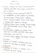
Remote sensing
Remote sensing is a powerful and versatile technology used to gather information about the Earth's surface and its environment without direct physical contact.
- Summary
- • 11 pages •
Remote sensing is a powerful and versatile technology used to gather information about the Earth's surface and its environment without direct physical contact.
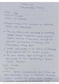
Photogrametry
Photogrammetry is a versatile and precise technique for obtaining detailed measurements and three-dimensional information about objects, terrain, and structures using photographs or imagery. It involves the process of capturing, analyzing, and interpreting photographs to derive accurate spatial data
- Class notes
- • 16 pages •
Photogrammetry is a versatile and precise technique for obtaining detailed measurements and three-dimensional information about objects, terrain, and structures using photographs or imagery. It involves the process of capturing, analyzing, and interpreting photographs to derive accurate spatial data
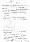
Basic Surveying
Surveying is a multidisciplinary practice that encompasses the art and science of measuring and mapping the Earth's surface and its features. It is a fundamental aspect of various fields, including civil engineering, construction, land management, urban planning, and environmental monitoring. The primary objective of surveying is to gather precise data about the shape, size, and location of physical objects and terrain on the Earth's surface.
- Class notes
- • 17 pages •
Surveying is a multidisciplinary practice that encompasses the art and science of measuring and mapping the Earth's surface and its features. It is a fundamental aspect of various fields, including civil engineering, construction, land management, urban planning, and environmental monitoring. The primary objective of surveying is to gather precise data about the shape, size, and location of physical objects and terrain on the Earth's surface.